
Download Light Pollution Map – free, secure, worldwide sky‑brightness viewer
Overview
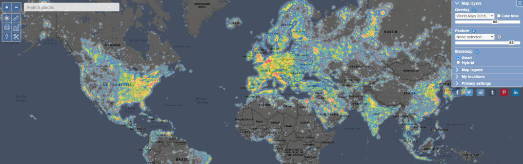
Light Pollution Map is a free, cross‑platform app that visualises artificial night‑sky brightness across the globe. By pulling together satellite imagery, ground‑based observations and sophisticated light‑scatter calculations, the tool paints a colour‑coded picture of where the night sky is brightest and where true darkness still survives. The primary mission of the app is to raise awareness about the growing problem of artificial light pollution, its impact on wildlife, ecosystems and human health, and to inspire individuals and communities to act.
Whether you are an astronomer searching for a dark‑sky observing site, a teacher preparing a lesson on environmental stewardship, or a traveller curious about the night‑time ambience of a new city, Light Pollution Map offers an intuitive way to explore and understand the distribution of artificial light. The interface lets you zoom, pan, and search for specific addresses or coordinates, while the overlay instantly shows the measured brightness level in magnitudes per square arc‑second. In addition to the visual map, the app provides educational resources, tips for reducing personal light footprints, and a community portal where users can submit their own observations, helping scientists refine the data and track changes over time.
By making complex data accessible and engaging, Light Pollution Map empowers a more informed public, encouraging actions that preserve dark skies for future generations.
Key Features, Pros & Cons
- Colour‑coded global light‑pollution overlay based on satellite and ground data.
- Interactive zoom and pan with high‑resolution detail down to city blocks.
- Search function for addresses, coordinates, or place names.
- Community submission portal for personal observations and photographs.
- Educational library covering causes, effects, and mitigation strategies.
- Regular data updates to reflect seasonal and infrastructural changes.
- Export map snapshots for reports, presentations or personal use.
- Offline mode for previously cached regions – ideal for remote fieldwork.
Pros
- Free and open access – no hidden fees or subscription required.
- User‑friendly interface that works for both novices and experts.
- Accurate, up‑to‑date data sourced from multiple reputable agencies.
- Educational focus with practical tips for reducing personal light footprints.
- Community‑driven contributions improve data coverage over time.
Cons
- Data gaps in extremely remote or sparsely populated regions.
- Limited customization of colour palettes for advanced users.
- Occasional lag when loading high‑resolution tiles on older devices.
Installation, Usage & Compatibility
Installing Light Pollution Map is straightforward on all major platforms. Visit the official website or your device’s app store, click “Download” and follow the on‑screen prompts. The installer size is under 50 MB, making it quick to download even on slower connections. After installation, launch the app and grant location permission if you wish to centre the map on your current position. The home screen presents a world view with a default brightness overlay; you can instantly switch between “All‑sky”, “Urban”, and “Rural” modes using the top‑right toggle.
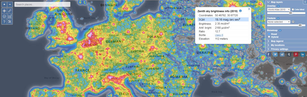
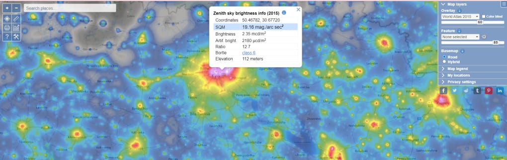
To explore a specific area, type a city name, postal code, or latitude/longitude into the search bar. The map will zoom to the requested location, displaying the colour‑coded light‑pollution level. Tap any point on the map to reveal a tooltip with precise measurements (e.g., 19.3 mag/arcsec²) and a short description of local lighting conditions. For researchers, the “Export” button creates a high‑resolution PNG or CSV file of the selected region, enabling offline analysis or inclusion in reports.
Light Pollution Map runs natively on Windows 10/11, macOS 10.13+, as well as mobile operating systems Android 6.0+ and iOS 12+. The application is built with responsive design principles, so the same codebase adapts to desktop, tablet and smartphone screens. System requirements are modest: a modern processor, at least 2 GB RAM, and an internet connection for the initial data download. Once data is cached, the offline mode works without connectivity, which is especially useful for field observations in remote locations.
FAQ – Frequently Asked Questions
How often is the light‑pollution data updated?
The map pulls data from satellite sources that are refreshed every 6‑12 months, complemented by crowd‑sourced ground observations which are uploaded continuously. This hybrid approach ensures a fairly recent representation of sky brightness.
Can I use the app for professional astronomical research?
Yes. While the app is primarily educational, the export feature provides raw numerical values and high‑resolution images that can be incorporated into scientific reports or used to plan observing sessions.
Is there a way to contribute my own light‑pollution measurements?
Absolutely. The “Community” tab lets you upload photos, note local lighting conditions, and suggest corrections. Submitted data are reviewed by moderators before being added to the global dataset.
Does the app work without an internet connection?
Once you have viewed a region, the map tiles are cached locally, allowing you to explore that area offline. However, new regions or the latest data require an internet connection to download.
What steps can I take to reduce light pollution in my neighbourhood?
The app’s education hub recommends using fully shielded fixtures, installing motion sensors, dimming outdoor lights after midnight, and advocating for municipal dark‑sky ordinances. Simple actions at home can collectively make a measurable difference.
Conclusion & Call to Action
Light Pollution Map delivers a compelling blend of scientific accuracy, educational value, and community engagement—all wrapped in a free, easy‑to‑use package. Its global coverage, intuitive interface, and practical tips make it an indispensable tool for anyone interested in preserving dark skies. While data gaps remain in the most remote corners of the planet, the app’s crowdsourced model promises continual improvement.
Ready to explore the night sky like never before? Download Light Pollution Map today and join a growing community dedicated to protecting our celestial heritage.



.png)